2018-11-08
Serving “Halt of construction†order on a house in Beit Ta’mar / Bethlehem governorate
Violation: Serving “Halt of construction” order on a house in Beit Ta’mar.
Location: Beit Ta’mar / Bethlehem governorate
Date: 8/11/2018.
Perpetrators: The Israeli occupation civil administration and army.
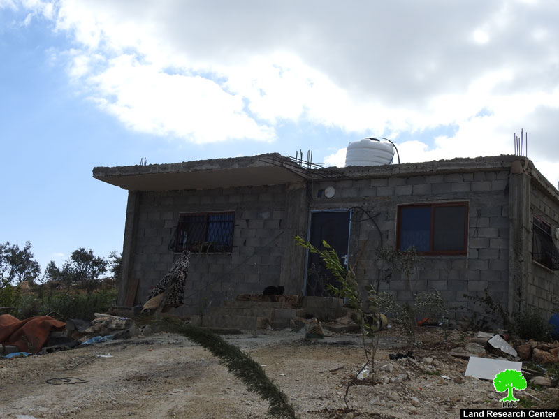
Victims: Nayef Zawahra.
Description:
The Israeli occupation civil administration and army raided Beir Ta’mar and served a “halt of construction” military order to citizen Nayef Zawahra on his house, on the pretext of unlicensed construction.
Noteworthy, the occupation prohibits any Palestinian expansion in the area, as they intent to establish a park for settlers and expand “Nokdim” illegal settlement.
Citizen Nayef Zawahra told LRC reporter:
“Settlers assault us regularly, they throw stones on our house to make us feel danger. My house is neither supplied with water nor electricity, due to the occupation’s measurements that prevent me from living my life normally”
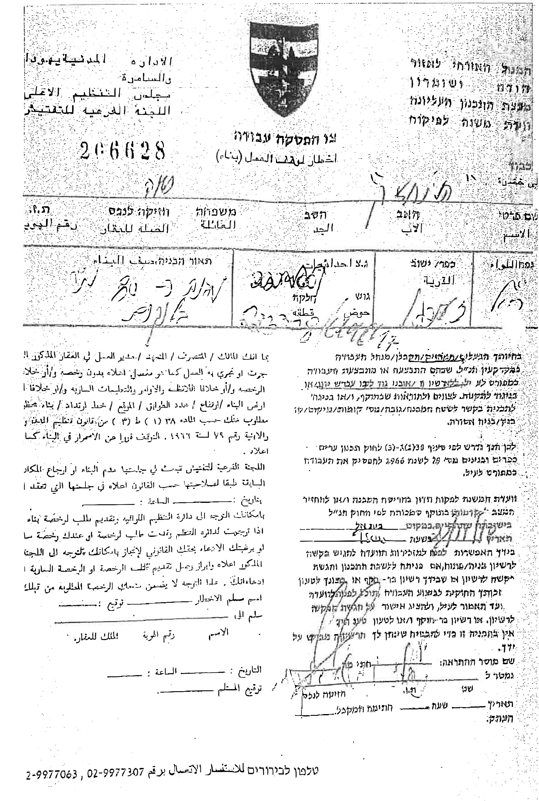
The military order said that the subcommittee will decide the fate of the structures in its session, in 27th November 2018.
|
|

More information about the owner:
name
|
Family members
|
minors
|
Area of the building
|
Status of the building
|
Number of the military order
|
Nayef Zawahra
|
12
|
9
|
120
|
House built of bricks
|
206628
|
Beit Ta'mar:[1]
5km to the southeast of Bethlehem, Beit Ta'mar is edged by Breid'a and Hindaza from the north, Janata area from the west and Za'tra town from the east.
With a total land area of 40077 dunums, of which 116 dunums are the town's built-up area, Beit Ta'mar is home for 1568 people (2014 census).
The Israeli occupation confiscated 260 dunums from the town to construct the following:
Al David colony that was established in 1999 on 65 confiscated dunums.
The bypass road that is opened on 185 confiscated dunums
A military camp that is set up on a 10 dunum area
According to the lands classifications of Oslo Accords, the lands of Beit Ta'mar are categorized as follows:
742 dunums are classified as area A
1601 dunums are classified as area B
1734 dunums are classified as area C
[1] GIS-LRC

The contents of this document is the sole responsibility of LRC and can under no circumstances be regarded as reflecting the position of the European Union